.jpg)

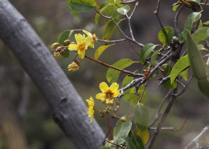
| Cochlospermum gillivraei | Cochlospermum gillivraei | |
|
|
.jpg) |
|
| Description:Flower and leaves | Description:Plant | |
| Location:Rex Lookout, Wangetti Beach, North Queensland | Location: Bob's Lookout, Mulligan Highway, North Queensland | |
| GPS coordinates:16˚38.8069S, 145˚33.9706E | GPS coordinates:16˚28.4754S, 144˚52.9968E | |
| Date of photo:25 August 2007 | Date of photo:19 July 2015 | |
| Field No.:U702 | Field No.:3231 | |
| Cochlospermum gillivraei | Cochlospermum gillivraei | |
|
|
|
|
| Description:Pod | Description:Pods | |
| Location:Possession Island, Torres Strait, North Queensland | Location:Possession Island, Torres Strait, North Queensland | |
| GPS coordinates:10˚42.9888S, 142˚23.7281E | GPS coordinates:10˚42.9888S, 142˚23.7281E | |
| Date of photo:15 November 2007 | Date of photo:15 November 2007 | |
| Field No.:U703 | Field No.:U703 | |
| Cochlospermum gillivraei | Cochlospermum gillivraei | |
|
|
|
|
| Description:Flowering tree | Description:Tree | |
| Location:Rex Lookout, Wangetti Beach, North Queensland | Location:Townsville Common, North Queensland | |
| GPS coordinates:16˚38.8069S, 145˚33.9706E | GPS coordinates:19˚12.0495S, 146˚44.2262E | |
| Date of photo:25 August 2007 | Date of photo:28 December 2006 | |
| Field No.:U702 | Field No.:U704 | |
| Cochlospermum gillivraei | Cochlospermum gillivraei | |
|
|
 |
|
| Description:Flower | Description:Flowers with creeping vine | |
| Location:Rex Lookout, Wangetti Beach, North Queensland | Location: Bob's Lookout, Mulligan Highway, North Queensland | |
| GPS coordinates:16˚38.8069S, 145˚33.9706E | GPS coordinates:16˚28.082S, 144˚53.114E | |
| Date of photo:25 August 2007 | Date of photo:19 July 2015 | |
| Field No.:U702 | Field No.:3231 |
References (accessed 23 September 2017):
George, A.S. in George, A.S. (ed.) (1982), Bixaceae. Flora of Australia 8:87http://anpsa.org.au/c-gil.html
Image use policy 
This work is licensed under a
Creative Commons Attribution-Noncommercial 2.5 Australia License.
Page created 21 July 2015
Page edited 23 September 2017
© Roger Fryer and Jill Newland 2015 - 2017