.JPG)

.JPG)
.JPG)
%20(31).JPG)
%20(30).JPG)
%20(37).JPG)
%20(35).JPG)
.JPG)
.JPG)
.JPG)
.JPG)
.JPG)
.JPG)
.JPG)
.JPG)
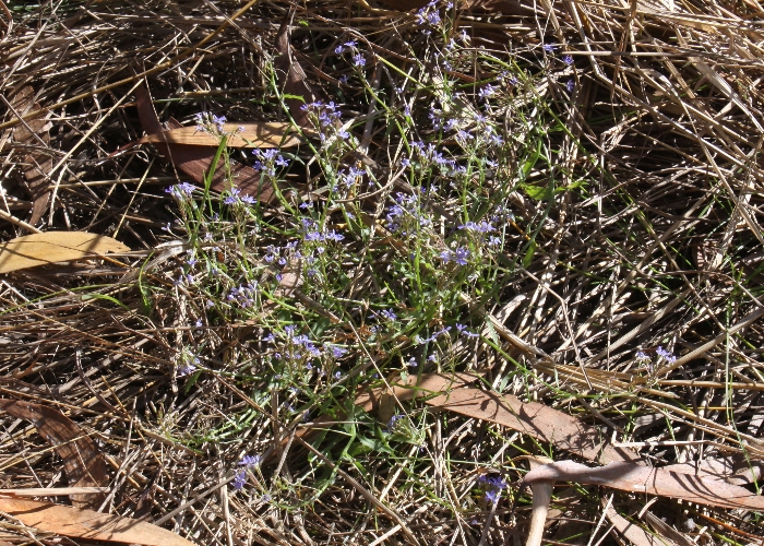
| Lobelia dioica | Lobelia dioica | |
.JPG) |
 |
|
| Description:Flowers | Description:Plant in-situ | |
| Location:Chong Swamp, Oyala Thumotang National Park, North Queensland | Location:Chong Swamp, Oyala Thumotang National Park, North Queensland | |
| GPS coordinates: 13˚36.769S 142˚34.946E | GPS coordinates: 13˚36.769S 142˚34.946E | |
| Date of photo:20 July 2010 | Date of photo:20 July 2010 | |
| Field No.:741 | Field No.:741 | |
| Lobelia dioica | Lobelia dioica | |
.JPG) |
.JPG) |
|
| Description:Flowers | Description:Flowers | |
| Location:Chong Swamp, Oyala Thumotang National Park, North Queensland | Location:Chong Swamp, Oyala Thumotang National Park, North Queensland | |
| GPS coordinates: 13˚36.769S 142˚34.946E | GPS coordinates: 13˚36.769S 142˚34.946E | |
| Date of photo:20 July 2010 | Date of photo:20 July 2010 | |
| Field No.:741 | Field No.:741 | |
| Lobelia dioica | Lobelia dioica | |
%20(31).JPG) |
%20(30).JPG) |
|
| Description:Flowers | Description:Flower - lateral view | |
| Location:Arnhem Highway, Northern Territory | Location:Arnhem Highway, Northern Territory | |
| GPS coordinates: 12˚41.957S 131˚24.013E | GPS coordinates: 12˚41.957S 131˚24.013E | |
| Date of photo:6 June 2015 | Date of photo:6 June 2015 | |
| Field No.:3173 | Field No.:3173 | |
| Lobelia dioica | Lobelia dioica | |
%20(37).JPG) |
%20(35).JPG) |
|
| Description:Flower | Description:Flowers and buds | |
| Location:Arnhem Highway, Northern Territory | Location:Arnhem Highway, Northern Territory | |
| GPS coordinates: 12˚41.957S 131˚24.013E | GPS coordinates: 12˚41.957S 131˚24.013E | |
| Date of photo:6 June 2015 | Date of photo:6 June 2015 | |
| Field No.:3173 | Field No.:3173 | |
| Lobelia dioica | Lobelia dioica | |
.JPG) |
.JPG) |
|
| Description:Flower | Description:Flower | |
| Location:Mitchell River Road, Kimberleys, Western Australia | Location:Mitchell River Road, Kimberleys, Western Australia | |
| GPS coordinates:14˚55.2054S, 126°13.4262E | GPS coordinates:14˚55.2054S, 126°13.4262E | |
| Date of photo:16 July 2016 | Date of photo:16 July 2016 | |
| Field No.:5065 | Field No.:5065 | |
| Lobelia dioica | Lobelia dioica | |
.JPG) |
.JPG) |
|
| Description:Flower with visiting fly | Description:Plant in habitat | |
| Location:Mitchell River Road, Kimberleys, Western Australia | Location:Mitchell River Road, Kimberleys, Western Australia | |
| GPS coordinates:14˚55.2054S, 126°13.4262E | GPS coordinates:14˚55.2054S, 126°13.4262E | |
| Date of photo:16 July 2016 | Date of photo:16 July 2016 | |
| Field No.:5065 | Field No.:5065 | |
| Lobelia dioica | Lobelia dioica | |
.JPG) |
.JPG) |
|
| Description:Leaf | Description:Leaf - underside | |
| Location:Howard Springs Rd, Northern Territory | Location:Howard Springs Rd, Northern Territory | |
| GPS coordinates: 12˚27.7758S 131˚02.7204E | GPS coordinates: 12˚27.7758S 131˚02.7204E | |
| Date of photo:26 May 2018 | Date of photo:26 May 2018 | |
| Field No.:6575 | Field No.:6575 | |
| Lobelia dioica | Lobelia dioica | |
.JPG) |
.JPG) |
|
| Description:Flowers | Description:Flowers - side view | |
| Location:Howard Springs Rd, Northern Territory | Location:Howard Springs Rd, Northern Territory | |
| GPS coordinates: 12˚27.7758S 131˚02.7204E | GPS coordinates: 12˚27.7758S 131˚02.7204E | |
| Date of photo:26 May 2018 | Date of photo:26 May 2018 | |
| Field No.:6575 | Field No.:6575 | |
Image use policy 
This work is licensed under a
Creative Commons Attribution-Noncommercial 2.5 Australia License.
Page created 7 March 2015
Page edited 25 June 2018
© Roger Fryer and Jill Newland 2015 - 2018