.JPG)
.JPG)
.JPG)
.JPG)
.JPG)

.JPG)
| Tristaniopsis exiliflora | Tristaniopsis exiliflora | |
.JPG) |
.JPG) |
|
| Description:Flower | Description:Flowers | |
| Location:Bare Hill Road, Davies Creek National Park, North Queensland | Location:Bare Hill Road, Davies Creek National Park, North Queensland | |
| GPS coordinates:16˚58.2762S, 145°35.1324E | GPS coordinates:16˚58.2762S, 145°35.1324E | |
| Date of photo:10 December 2017 | Date of photo:10 December 2017 | |
| Field No.:6297 | Field No.:6297 | |
| Tristaniopsis exiliflora | Tristaniopsis exiliflora | |
|
|
|
|
| Description:Flowers | Description:Flowers and leaves | |
| Location:Bare Hill Road, Davies Creek National Park, North Queensland | Location:Bare Hill Road, Davies Creek National Park, North Queensland | |
| GPS coordinates:16˚58.1148S, 145°35.8378E | GPS coordinates:16˚58.1148S, 145°35.8378E | |
| Date of photo:12 December 2018 | Date of photo:12 December 2018 | |
| Field No.:7613 | Field No.:7613 | |
| Tristaniopsis exiliflora | Tristaniopsis exiliflora | |
.JPG) |
.JPG) |
|
| Description:Flowers - side view | Description:Leaf | |
| Location:Bare Hill Road, Davies Creek National Park, North Queensland | Location:Bare Hill Road, Davies Creek National Park, North Queensland | |
| GPS coordinates:16˚58.2762S, 145°35.1324E | GPS coordinates:16˚58.2762S, 145°35.1324E | |
| Date of photo:10 December 2017 | Date of photo:10 December 2017 | |
| Field No.:6297 | Field No.:6297 | |
| Tristaniopsis exiliflora | Tristaniopsis exiliflora | |
.JPG) |
|
|
| Description:Flowers and leaves | Description:Tree next to stream | |
| Location:Bare Hill Road, Davies Creek National Park, North Queensland | Location: Davies Creek National Park, North Queensland | |
| GPS coordinates:16˚58.2762S, 145°35.1324E | GPS coordinates:17˚00.6654S, 145°34.9200E | |
| Date of photo:10 December 2017 | Date of photo:18 February 2018 | |
| Field No.:6297 | Field No.:6379 | |
| Tristaniopsis exiliflora | Tristaniopsis exiliflora | |
 |
.JPG) |
|
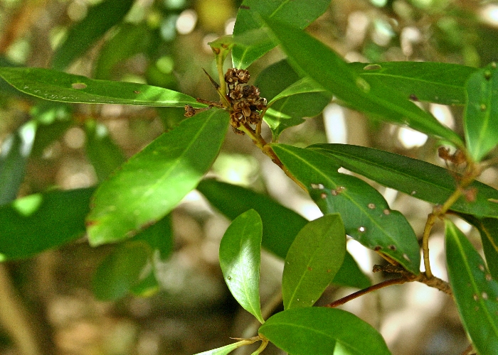
| Description:Leaves and old flowers | Description:Leaves - underside | |
| Location: Davies Creek National Park, North Queensland | Location:Bare Hill Road, Davies Creek National Park, North Queensland | |
| GPS coordinates:17˚00.6260S, 145°34.4450E | GPS coordinates:16˚58.2762S, 145°35.1324E | |
| Date of photo:13 May 2007 | Date of photo:10 December 2017 | |
| Field No.:U983 | Field No.:6297 | |
References (accessed 19 January 2019):
Image use policy 
This work is licensed under a
Creative Commons Attribution-Noncommercial 2.5 Australia License.
Page created 15 January 2018
Page edited 19 January 2019
© Roger Fryer and Jill Newland 2018 - 2019