.JPG)
24.JPG)
.JPG)
.JPG)
.JPG)
.JPG)
| Nepenthes mirabilis | Nepenthes mirabilis | |
| |
|
|
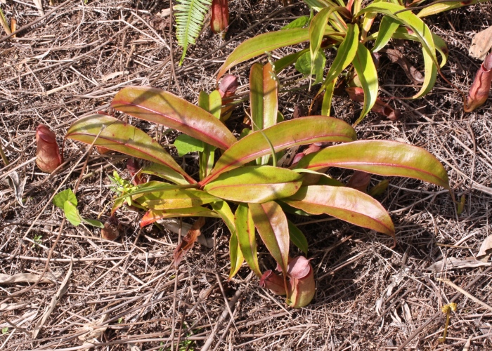
| Description:Pitcher | Description: Whole plant | |
| Location:Bramston Beach Rd, North Queensland | Location:Iron Range, Cape York, North Queensland | |
| GPS coordinates:17˚23.0538S, 145˚58.9164E | GPS coordinates:12˚43.5120S, 143˚12.0530E | |
| Date of photo:8 August 2009 | Date of photo:24 September 2007 | |
| Field No.:538 | Field No.:U1257 | |
| Nepenthes mirabilis | Nepenthes mirabilis | |
|
|
|
|
| Description:Flower spike | Description: Seed pods | |
| Location:Bramston Beach Rd, North Queensland | Location:Bramston Beach Rd, North Queensland | |
| GPS coordinates:17˚23.0538S, 145˚58.9164E | GPS coordinates:17˚23.0538S, 145˚58.9164E | |
| Date of photo:30 May 2010 | Date of photo:30 May 2010 | |
| Field No.:670 | Field No.:670 | |
| Nepenthes mirabilis | Nepenthes mirabilis | |
|
|
|
|
| Description:Flower spike | Description: Plant in habitat | |
| Location:Bramston Beach Rd, North Queensland | Location:Bramston Beach Rd, North Queensland | |
| GPS coordinates:17˚23.0538S, 145˚58.9164E | GPS coordinates:17˚23.0538S, 145˚58.9164E | |
| Date of photo:30 May 2010 | Date of photo:3 May 2010 | |
| Field No.:670 | Field No.:670 | |
| Nepenthes mirabilis | Nepenthes mirabilis | |
|
|
|
|
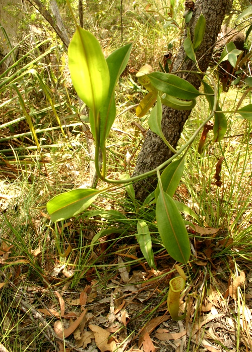
| Description: Whole plant in habitat | Description: Tiny plant | |
| Location:Bramston Beach Rd, North Queensland | Location:Tozer's Gap, Cape York, North Queensland | |
| GPS coordinates:17˚23.0538S, 145˚58.9164E | GPS coordinates:12˚43.966S, 143˚12.762E | |
| Date of photo:8 August 2009 | Date of photo:4 June 2013 | |
| Field No.:538 | Field No.:2094A |
References (accessed 2 October 2017):
Image use policy 
This work is licensed under a
Creative Commons Attribution-Noncommercial 2.5 Australia License.
Page created 30 August 2010
Page edited 10 December 2018
© Roger Fryer and Jill Newland 2010 - 2017