.JPG)
.JPG)
.JPG)
.JPG)
.JPG)
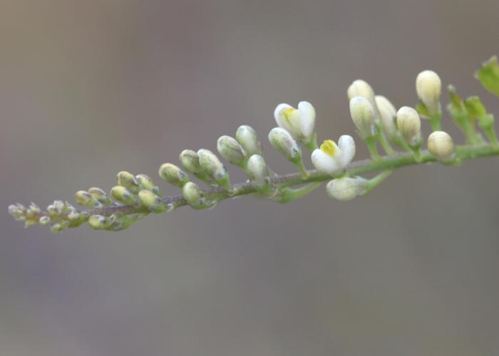
| Comesperma secundum | Comesperma secundum | |
|
|
|
|
| Description:Flowers | Description:Flower spike and leaves | |
| Location:Garraway Creek, Iron Range, North Queensland | Location:Cape Bedford Road, Hopevale, North Queensland | |
| GPS coordinates: 12º43.396S, 143º09.825E | GPS coordinates: 15º16.8840S, 145º12.5502E | |
| Date of photo:2 June 2013 | Date of photo:17 March 2017 | |
| Field No:2088 | Field No:6011 | |
| Comesperma secundum | Comesperma secundum | |
|
|
|
|
| Description:Flowers | Description:Flowers and leaves | |
| Location:Road to Isabella Falls, Cooktown, North Queensland | Location:Road to Isabella Falls, Cooktown, North Queensland | |
| GPS coordinates: 15º18.330S, 145º0.759E | GPS coordinates: 15º18.330S, 145º0.759E | |
| Date of photo:30 March 2015 | Date of photo:30 March 2015 | |
| Field No:3053 | Field No:3053 | |
| Comesperma secundum | Comesperma secundum | |
|
|
|
|
| Description:Plant | Description:Plant in habitat with Lomandra banksii | |
| Location:Cape Bedford Road, Hopevale, North Queensland | Location:Cape Bedford Road, Hopevale, North Queensland | |
| GPS coordinates: 15º16.8840S, 145º12.5502E | GPS coordinates: 15º16.8840S, 145º12.5502E | |
| Date of photo:17 March 2017 | Date of photo:17 March 2017 | |
| Field No:6011 | Field No:6011 |
Image use policy 
This work is licensed under a
Creative Commons Attribution-Noncommercial 2.5 Australia License.
Page created 29 June 2013
Page edited 12 May 2017
© Roger Fryer and Jill Newland 2013 - 2017
Comesperma secundum