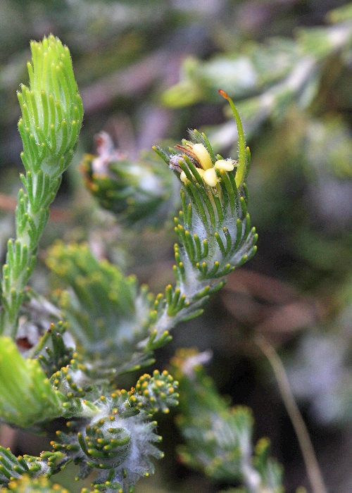
| Adenanthos terminalis | Adenanthos terminalis | |
|
|
|
|
| Description:Flower | Description:Flowers and leaves | |
| Location:West Point Rd, Kangaroo Island, South Australia | Location:West Point Rd, Kangaroo Island, South Australia | |
| GPS coordinates:35˚56.887S 136˚41.678E | GPS coordinates:35˚56.887S 136˚41.678E | |
| Date of photo:9 November 2015 | Date of photo:9 November 2015 | |
| Field No.:2871A | Field No.:2871A | |
| Adenanthos terminalis | Adenanthos terminalis | |
|
|
|
|
| Description:Flower and leaves | Description:Flower and leaves | |
| Location:Flinders Highway, Coulta, Eyre Peninsula, South Australia | Location:Flinders Highway, Coulta, Eyre Peninsula, South Australia | |
| GPS coordinates:35˚56.887S 136˚41.678E | GPS coordinates:35˚56.887S 136˚41.678E | |
| Date of photo:17 November 2015 | Date of photo:17 November 2015 | |
| Field No.:2947 | Field No.:2947 | |
| Adenanthos terminalis | Adenanthos terminalis | |
 |
|
|
| Description:Plant | Description:Plant in habitat | |
| Location:Flinders Highway, Coulta, Eyre Peninsula, South Australia | Location:West Point Rd, Kangaroo Island, South Australia | |
| GPS coordinates:35˚56.887S 136˚41.678E | GPS coordinates:35˚56.887S 136˚41.678E | |
| Date of photo:17 November 2015 | Date of photo:9 November 2015 | |
| Field No.:2947 | Field No.:2871A | |
Image use policy 
This work is licensed under a
Creative Commons Attribution-Noncommercial 2.5 Australia License.
Page created 28 July 2015
Page edited 5 July 2017
© Roger Fryer and Jill Newland 2015 - 2017