Grevillea dryandri subsp. dryandri
.JPG)
.JPG)
.JPG)
.JPG)
.JPG)
.JPG)
.JPG)
.JPG)
|
Grevillea dryandri subsp. dryandri |
Grevillea dryandri subsp. dryandri | |
|
|
|
|
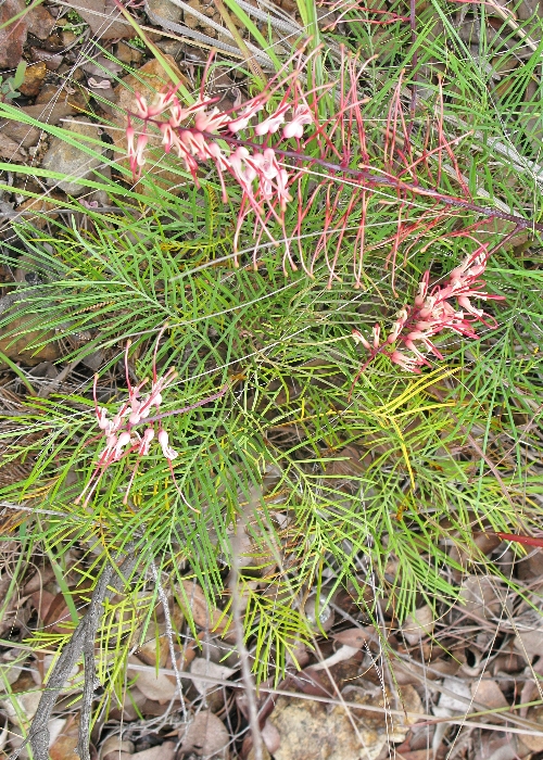
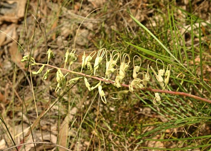
| Description:Flowers | Description:Flowers | |
| Location:Mt Misery, Irvinebank Rd, North Queensland | Location:Petford, North Queensland | |
| GPS coordinates:17˚28.0820S,145˚13.8640E | GPS coordinates:N/A | |
| Date of photo:18 December 2011 | Date of photo:30 December 2007 | |
| Field No.:U317 | Field No.:U318 | |
| Grevillea dryandri subsp. dryandri | Grevillea dryandri subsp. dryandri | |
|
|
|
|
| Description:Flowers and leaves | Description:Flowers and leaves | |
| Location:Herberton Range, North Queensland | Location:Peninsula Development Rd, Laura, North Queensland | |
| GPS coordinates:17˚20.4324S,145˚25.1988E | GPS coordinates:15˚38.895S,144˚31.541E | |
| Date of photo:10 February 2007 | Date of photo:31 March 2015 | |
| Field No.:U319 | Field No.:3080 | |
| Grevillea dryandri subsp. dryandri | Grevillea dryandri subsp. dryandri | |
|
|
|
|
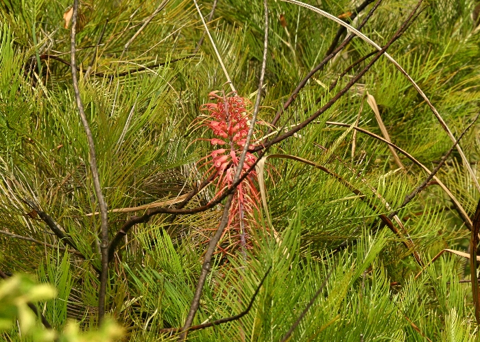
| Description:Flower and leaves | Description:Whole Plant | |
| Location:Petford, North Queensland | Location:Castle Hill, Townsville, North Queensland | |
| GPS coordinates:N/A | GPS coordinates:19˚15.4965S,146˚48.1946E | |
| Date of photo:30 December 2007 | Date of photo:25 December 2007 | |
| Field No.:U318 | Field No.:U321 | |
| Grevillea dryandri subsp. dryandri | Grevillea dryandri subsp. dryandri | |
|
|
|
|
| Description:Flower and leaves | Description:Flowers (white variety) | |
| Location:Castle Hill, Townsville, North Queensland | Location:Jumna Creek, Irvinebank, North Queensland | |
| GPS coordinates:19˚15.4965S,146˚48.1946E | GPS coordinates:17˚23.353S,145˚19.940E | |
| Date of photo:25 December 2007 | Date of photo:1 March 2008 | |
| Field No.:U321 | Field No.:U320 | |
| Grevillea dryandri subsp. dasycarpa McGill. | ||
| This subspecies is endemic to the Northern Territory. | ||
| Grevillea dryandri subsp. dasycarpa | Grevillea dryandri subsp. dasycarpa | |
|
|
|
|
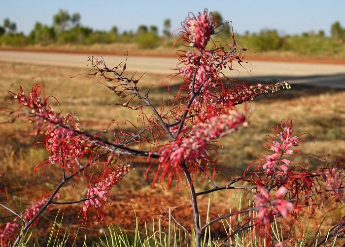
| Description:Flowers | Description:Flowers | |
| Location:Katherine, Northern Territory | Location:Nourlangie Rock, Kakadu, Northern Territory | |
| GPS coordinates:N/A | GPS coordinates:12˚52.015S,132˚48.738E | |
| Date of photo:4 September 2007 | Date of photo:7 June 2015 | |
| Field No.:U322 | Field No.:3194 | |
| Grevillea dryandri subsp. dasycarpa | Grevillea dryandri subsp. dasycarpa | |
|
|
|
|
| Description:Flowers | Description:Plant in habitat | |
| Location:Nourlangie Rock, Kakadu, Northern Territory | Location:Nourlangie Rock, Kakadu, Northern Territory | |
| GPS coordinates:12˚52.015S,132˚48.738E | GPS coordinates:12˚52.015S,132˚48.738E | |
| Date of photo:7 June 2015 | Date of photo:7 June 2015 | |
| Field No.:3194 | Field No.:3194 | |
References (accessed 1 July 2017):
Williams, K.A.W., (1980) Native Plants of Queensland. 1:134
Image use policy 
This work is licensed under a
Creative Commons Attribution-Noncommercial 2.5 Australia License.
Page created 13 June 2015
Page edited 1 July 2017
© Roger Fryer and Jill Newland 2015 - 2017