Australian Coastal Plants -
Rhizopheraceae
Bruguiera Plant list Home
Bruguiera Plant list Home
Bruguiera exaristata Ding Hou
Rib-fruited Orange Mangrove
| Bruguiera exaristata | Bruguiera exaristata | ||
1.JPG) |
.JPG) |
||
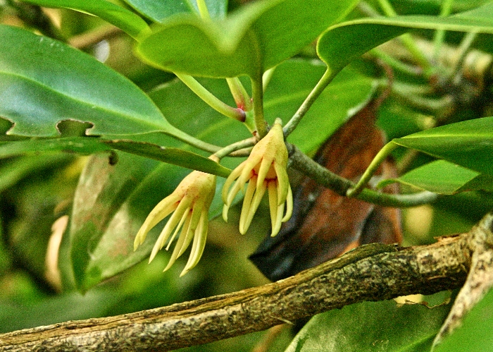
| Description:Calyx | Description:Flower and buds | ||
| Location:Florence Bay, Magnetic Island, North Queensland | Location:Florence Bay, Magnetic Island, North Queensland | ||
| GPS coordinates: 19˚07.3408S, 146˚52.6712E | GPS coordinates: 19˚07.3408S, 146˚52.6712E | ||
| Date of photo:24 April 2011 | Date of photo:24 April 2011 | ||
| Field No.:U116 | Field No.:U116 | ||
| Bruguiera exaristata | Bruguiera exaristata | ||
1.JPG) |
.JPG) |
||
| Description:Flower | Description:Flower | ||
| Location:Florence Bay, Magnetic Island, North Queensland | Location:Florence Bay, Magnetic Island, North Queensland | ||
| GPS coordinates: 19˚07.3408S, 146˚52.6712E | GPS coordinates: 19˚07.3408S, 146˚52.6712E | ||
| Date of photo:24 April 2011 | Date of photo:24 April 2011 | ||
| Field No.:U116 | Field No.:U116 | ||
| Bruguiera exaristata | Bruguiera exaristata | ||
 |
.JPG) |
||
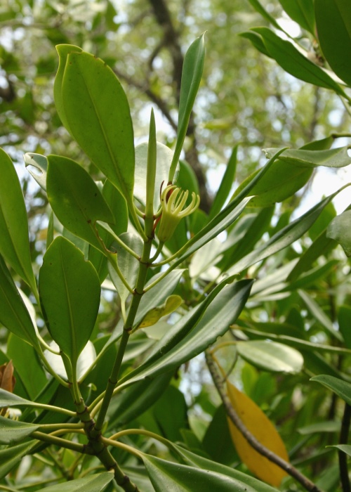
| Description:Calyces | Description:Flowers and leaves | ||
| Location:Esplanade, Cairns, North Queensland | Location:Esplanade, Cairns, North Queensland | ||
| GPS coordinates: 16˚54.1542S, 145˚45.7072E | GPS coordinates: 16˚54.1542S, 145˚45.7072E | ||
| Date of photo:14 April 2007 | Date of photo:14 April 2007 | ||
| Field No.:U117 | Field No.:U117 | ||
| Bruguiera exaristata | Bruguiera exaristata | ||
 |
.JPG) |
||
| Description:Calyx and leaves | Description:Tree | ||
| Location:Crab Island, Torres Strait, North Queensland | Location:Florence Bay, Magnetic Island, North Queensland | ||
| GPS coordinates: 10˚58.4965S, 142˚06.0376E | GPS coordinates: 19˚07.3408S, 146˚52.6712E | ||
| Date of photo:14 November 2007 | Date of photo:24 April 2011 | ||
| Field No.:U119 | Field No.:U116 | ||
| Bruguiera exaristata | Bruguiera exaristata | ||
.JPG) |
.JPG) |
||
| Description:Calyx and leaves | Description:Plant | ||
| Location:Holloway's Beach, Cairns, North Queensland | Location:Holloway's Beach, Cairns, North Queensland | ||
| GPS coordinates:16˚49.8012S, 145°43.9764E | GPS coordinates:16˚49.8012S, 145°43.9764E | ||
| Date of photo:18 September 2016 | Date of photo:18 September 2016 | ||
| Field No.:5716 | Field No.:5716 | ||
| Bruguiera exaristata | Bruguiera exaristata | ||
|
|
|
||
| Description:Hypocotyl | Description:Plant | ||
| Location:Trinity Park, North Queensland | Location:Trinity Park, North Queensland | ||
| GPS coordinates:16˚48.0366S, 145°42.4602E | GPS coordinates:16˚48.0366S, 145°42.4602E | ||
| Date of photo:18 January 2017 | Date of photo:18 January 2017 | ||
| Field No.:5944 | Field No.:5944 | ||
Duke N. C. (2006), Australia's Mangroves - the authoritative guide to Australia's mangrove plants, University of Queensland.
McCusker, A. in George, A.S. (ed.) (1984), Rhizophoraceae. Flora of Australia 22:5
Image use policy 
This work is licensed under a
Creative Commons Attribution-Noncommercial 2.5 Australia License.
Page created 10 June 2011
Page edited 12 August 2017
© Roger Fryer and Jill Newland 2011 - 2017