.JPG)
.JPG)
.JPG)
.JPG)
.JPG)
.JPG)
.JPG)
.JPG)
.JPG)
| Coelospermum decipiens | Coelospermum decipiens | |
|
|
|
|
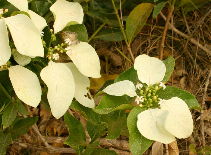
| Description:Flower and buds | Description:Flowers and white bracts | |
| Location:Road to Chilli Beach, Iron Range, North Queensland | Location:Chilli Beach, Iron Range, North Queensland | |
| GPS coordinates:12˚41.620S, 142°20.107E | GPS coordinates:12˚37.275S, 143°26.271E | |
| Date of photo:2 June 2013 | Date of photo:24 September 2007 | |
| Field No:2093 | Field No:U847 | |
| Coelospermum decipiens | Coelospermum decipiens | |
|
|
|
|
| Description:Plant | Description:Plants on roadside | |
| Location:Chilli Beach, Iron Range, North Queensland | Location:Road to Chilli Beach, Iron Range, North Queensland | |
| GPS coordinates:12˚37.275S, 143°26.271E | GPS coordinates:12˚41.620S, 142°20.107E | |
| Date of photo:24 September 2007 | Date of photo:2 June 2013 | |
| Field No:U847 | Field No:2093 | |
| Coelospermum decipiens | Coelospermum decipiens | |
|
|
|
|
| Description:Flowers and bracts | Description:Plant | |
| Location:Road to Chilli Beach, Iron Range, North Queensland | Location:Chilli Beach, Iron Range, North Queensland | |
| GPS coordinates:12˚41.620S, 142°20.107E | GPS coordinates:12˚37.275S, 143°26.271E | |
| Date of photo:2 June 2013 | Date of photo:24 September 2007 | |
| Field No:2093 | Field No:U847 | |
| Coelospermum decipiens | Coelospermum decipiens | |
|
|
|
|
| Description:Flowers and bracts | Description:Flowers and bracts | |
| Location:Road to Isabella Falls, Cooktown, North Queensland | Location:Road to Isabella Falls, Cooktown, North Queensland | |
| GPS coordinates:15˚18.6030S, 145°01.1580E | GPS coordinates:15˚18.6030S, 145°01.1580E | |
| Date of photo:10 March 2017 | Date of photo:10 March 2017 | |
| Field No:6006 | Field No:6006 | |
| Coelospermum decipiens | Coelospermum decipiens | |
|
|
|
|
| Description:Flowers and bracts - side view | Description:Plant on roadside | |
| Location:Road to Isabella Falls, Cooktown, North Queensland | Location:Road to Isabella Falls, Cooktown, North Queensland | |
| GPS coordinates:15˚18.6030S, 145°01.1580E | GPS coordinates:15˚18.6030S, 145°01.1580E | |
| Date of photo:10 March 2017 | Date of photo:10 March 2017 | |
| Field No:6006 | Field No:6006 | |
References (accessed 19 February 2017):
Image use policy 
This work is licensed under a
Creative Commons Attribution-Noncommercial 2.5 Australia License.
Page created 19 February 2017
Page edited 12 May 2017
© Roger Fryer and Jill Newland 2017
Coelospermum decipiens